A legacy in Data

Original dataset safely waiting at UW Madison
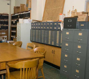
The original work done by Dr. John T. Curtis and his students and colleagues in the 1940s and 50s (see History) produced a rich legacy of qualitative and quantitative field data, archived in the Ecology Records Room in Birge Hall (see photo). These data extend to over 1000 sites, providing the basis for the careful descriptions of Wisconsin's plant communities summarized in The Vegetation of Wisconsin. These sites cover a wide range of Wisconsin's native plant communities and include at a minimum a map showing the location and a list of the species observed. Data from the open communities usually also includes information on percent cover by species. Data from the forested sites usually includes plotless estimates of overstory conditions (the frequency and size [DBH] of ~80 trees at each site) plus the frequency at which understory species occurred across 20-40 spaced 1 m2 quadrats. We also have data on soil conditions from some sites. Much of this information has been, or is being, digitized to facilitate analyses and comparisons with contemporary resurvey data.
Assessing ecological change
These legacy data provide a uniquely detailed baseline for assessing ecological change at the sites surveyed. The
large number of sites and species and the 50+ years that have elapsed between samples allow us to evaluate trends
in detail with considerable statistical power. These comparisons allows us to track species invasions, local
extinctions, changes in community diversity and composition (e.g., homogenization), and shifts in species' local
and regional abundances. We are now trying to relate these changes to shifts in succession, local site conditions,
surrounding landscape structure, climate, disturbance regimes, and herbivory by white-tailed deer. The broad
spectrum of species and communities sampled thus provide considerable power not only for detecting changes but also
for identifying the drivers of change. For more detailed descriptions of work in particular community types,
see the Communities
page. This work has been supported by the National Science Foundation (NSF), the USDA-NRI - CREEES program, and the UW Graduate School. .
Legacy data files
Charles Umbanhowar, now at St. Olaf College, initiated efforts to digitize the valuable PEL legacy data.
His work is now posted online and can be found at his PEL
data website. Data available there (in a Lotus 123 format) spans all the communities surveyed by the original
PEL teams. Not all the data could be digitized due to funding constraints.
We are now integrating both historical and contemporary data files on plant presence and abundance into a more comprehensive data base. In addition, we are measuring and digitizing a broad set of geographic (GIS) data for many of the PEL sites. To complement these data sets, we are also measuring and digitizing data on many ecologically relevant traits for each species (height and growth form; leaf nitrogen, area, thickness, toughness, and SLA; modes of pollination and dispersal, etc.). We will use data on these functional traits to explore how well they predict the historical changes we have observed in plant distribution and abundance.


